
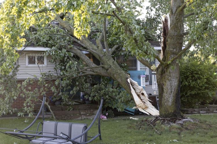


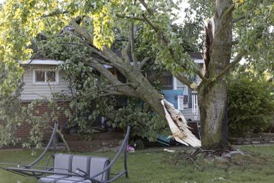
Storms accompanied by deep, booming thunder, lightning displays and powerful winds swept through parts of Wisconsin, Illinois, northern Indiana and Michigan overnight ŌĆö leaving scores of trees down and thousands of homes without power.
The National Weather Service issued tornado warnings and watches across the region Thursday night into early Friday morning. Several tornadoes touched down Thursday in central Wisconsin. None of the twisters have received ratings yet, said Timm Uhlmann, weather service meteorologist in Green Bay.
ŌĆ£WeŌĆÖre still gathering reports,ŌĆØ Uhlmann said. ŌĆ£WeŌĆÖre assessing some of the damage and still getting video and pictures. The damage that we have is fairly widespread. There was a lot of large hail. In Eau Claire was one report of softball-sized hail.ŌĆØ
No injuries have been reported.
Surveys also were underway Friday of damage in Michigan to determine if any tornadoes touched down there, according to Steven Freitag, a meteorologist with the National Weather Service in White Lake Township, northwest of Detroit.
The storms were fueled by temperatures in the lower 80s that stretched from Illinois into Michigan and were activated by a cold front that pushed through, Freitag said.
A wind gust of 76 mph (122 kph) was reported Thursday night in Battle Creek, Michigan, while Grand Haven, Michigan, recorded a gust of 68 mph (109 kph).
The storms lost their intensity as they moved further east, Freitag added.
Indiana Michigan Power, which services parts of northern Indiana and southwestern Michigan, reported Friday morning that more than 31,000 homes and businesses were without electricity. That includes about 90% of the utility’s southwestern Michigan customers.
The storms initially knocked out power to 35,000 customers. Damage included downed trees and power lines, and broken utility poles.
About 216,000 Consumers Energy customers in Michigan also lost power.
ComEd crews in Illinois were working Friday to restore power to about 73,000 of more 155,000 customers who initially lost service Thursday, the utility said. It said Chicago, Joliet and Crestwood were among the hardest hit areas.
The threat of severe weather in Chicago delayed a Beyonce concert by about two hours Thursday at Soldier Field.
Freitag said the main cold front was still moving east Friday. Severe thunderstorms were expected to continue through parts of Kentucky, Tennessee, Arkansas, Missouri, southern Illinois and southern Indiana, the weather service said.
Those storms could produce some hurricane-force winds, tornadoes and baseball-size hail.
ŌĆ£This will include intense supercells associated with tornadoes, large hail and wind damage,ŌĆØ the weather service said on its Storm Prediction Center webpage. ŌĆ£Several strong tornadoes are expected, and a long-track high-end tornado will be possible.ŌĆØ
Searing heat was forecast Friday for the South and southeastern United States. From Texas into eastern Virginia, temperatures were expected to top 80 degrees Fahrenheit (26.7 degrees Celsius) and even move above 90 F (32.2 C) in some places, according to the weather service.
A heat advisory was issued for the San Antonio and Austin areas in Texas with high temperatures at a blistering 95 F (35 C) to 105 (40.5 C). By 1 p.m. Friday, the temperature in Tampa, Florida, had already topped 90. A high of 90 was expected for Washington.
The National Weather Service Office for Austin/San Antonio said Friday the humidity coming in over the weekend is expected to make temperatures hotter.
ŌĆ£There are concerns of heat exhaustion for people that arenŌĆÖt taking proper precautions when theyŌĆÖre outdoors,ŌĆØ meteorologist Jason Runyen said. He advised those affected to take breaks and stay hydrated.
Runyen added that temperatures could drop next week if showers make their way through the Hill Country. He said that could bring temperatures closer to what they usually are this time of year.
_________________
AP reporter Haya Panjwani in Washington contributed to this story.


